Tuesday, December 7, 2010

Joshua Tree, California

 Jumbo Rocks

Joshua Tree is Sancho's favorite national park (so far).  It is located where two deserts - the Mojave and the Colorado - collide.  The Mojave desert part of the park is probably what comes to mind if you've ever seen pictures of Joshua Tree or been there -- the cactus-like Joshua trees and the rough rocks with pleasing curves.

The Colorado desert, on the other hand, is located on the east side of the park and is less frequented by visitors -- probably because there are few (if any) Joshua Trees and no big rocks to climb.  But the Colorado desert is home to interesting plants that do not grow in the Mojave.  For example, the cholla cactus.

cholla cactus

We took an interesting side trip to Keys Point lookout, where we came across a couple scattering someone's ashes to the wind and a sweet view of the San Andreas Fault.  It was all very epic.

San Andreas Fault

In the picture above, the San Andreas fault is not the bumpy hills in the foreground (those are Indio Hills), and not the big mountains in the background, but the distinct and straight ridge at low elevation between the bumpy Indio Hills and big mountains.

We camped, we hiked, we looked for bolted rock routes but found only sketchy ones.  There are thousands of routes at Joshua Tree; it is a sort of climbing mecca.  We avoided the popular spots (and probably all the bolted routes) like Hidden Valley where we saw tons of climbers.  Next time we'll bring a climber friend or a guide book.

Not to be left out of the rock climbing action, nearly every rock we encountered was scalable without the use of rope.  Felt free.


One reason Joshua Tree is so appealing is that despite its desert climate and inhospitable (to humans) landscape, the curved rocks form a sort of rock garden that gives a feeling of shelter and positive energy  Plus, you get the sense that you are not lost in a great abyss, as you do in so many other deserts (like the Colorado & Death Valley).  But, of course, you are lost in a great abyss.

I knit this little pouch that turned out to be just the right size for my squat little cell phone.  Why is it so satisfying to cover technology with sweaters??


At the moment we're in a Super 8 motel in Phoenix, Arizona.  We're about to visit Windspirit Community.

Saturday, December 4, 2010

San Diego, California


Visited cousin Eva in San Diego.  It was a much pleasanter urban driving experience than San Francisco.  Gas was cheaper, tolls were absent, fish tacos abundant, and the smell of fresh bud everywhere.  It's no wonder the inhabitants are lulled into the empty promise of endless summer.

We had a relaxing time hanging out at Eva's relaxing home -- replete with Linden art, a fully stocked kitchen, a "guest bedroom," and a neighbor's friendly cat.  Too bad most of her neighbors are douchebags.

hiking Torrey Pines state reserve

She took us to Torrey Pines state reserve, known for its endangered Torrey Pine trees.  These trees are the rarest pines in all the states, growing only in San Diego county and on one of the Channel Islands off the coast of southern California.

The cliffs on the beach looked "eminently climbable," as Sanch is apt to say, but the rock was semi-solid sand, just waiting to let loose.

Sanch, Eva, sandy cliffs

We met this gull, who was rotund and confused.  I hope it all works out.

wishing you well

gull fest

San Diego was a great spot.  Sure it was excessively blonde, self-consciously hetero and full of highway billboards for the "LAP BAND" weight loss ploy, but what's southern California if not a little Baywatch?

Thursday, December 2, 2010

Death Valley, California

 mesquite sand dunes

Death Valley National Park is awesome.  I/pictures cannot explain what it is like, other than: Death Valley is a feeling.  Music sounds better there.  If you're not a person who enjoys extremes, you may not like it, but you'll never forget it.  In fact it will probably scare you and you'll swear never to return.  If you enjoy extremes, you will thoroughly enjoy the valley of death.

Death and Valleys both rank high on my list of interests, right up there with Life and Mountains.  Polarize me.

Other things that rank high are Camping and Free.  National Parks are hit or miss when it comes to free camping.  Death Valley has more free campgrounds than pay campgrounds.  Of course, you have to be willing to drive 20-30 miles away from the main attractions and down poorly maintained dirt roads.  It sure helps keep away the conservative RV crowd (generalization).

Ol' NorthFace loves desert climate

 Camping, Free, Death, Life, Valley, Mountains, AHHHHhh

By now, of course, the unchecked poison oak has raged to the extreme.  And with no chance of remedy within 100 miles, we were left to simmer in our own allergic reactions.  Some local beer took the edge off.  It is brewed in Inyokern, CA -- a tiny town we drove through on our way to Death Valley National Park.


Not that Norbie gets jealous or feels inadequate when he greets the high volume of RVs on the western road, but he sure loves it when we treat him like an RV.  After all, he provides recreation and he's a vehicle.  Why not?

RV or Norbie?

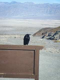
The ravens in Death Valley are a strong presence.  They make lots of pissed-off sounds while wildly shrugging their shoulders.  I've never seen anything like it in my limited experience with other ravens.  They seem to communicate that they are pissed off at the unnatural influx of people to their land, and could we all just go back to our condos and burn down the bathrooms on our way out?

Death Valley Raven

We hiked through Mosaic Canyon.  It was pretty vast.


Then we took a stroll through the sand dunes.  Nothing feels better on bare feet/the soul than warm sand dunes with the occasional pricker and sidewinder rattlesnake tracks.

Free, Life, Death, Valley


The park is enormous.  It is the largest national park in the continental US (not counting Alaska parks).


Norbie enjoys life
 
"Devil's Golf Course"

Wee coyote  -- young or just small?


After we left the park and gained cell phone service 100 miles later I told my parents how beautiful Death Valley is.  My mom would hear none of it -- "I've been to the desert, I know what it's like, and I don't like it" me: "Yeah but you haven't been to DEATH VALLEY"

Monday, November 29, 2010

Sierra Madre Range, California

Took route 101 down the coast from San Francisco to south of San Luis Obispo, where we turned east on state route 166.  166 cuts through the scenic Sierra Madres and offers sweeping views of mountains and valleys, as well as the cattle that dot its landscape.  There are few homesteads and no services (read: gas).  It's a great drive, I recommend it.  The mostly public land along 166 is a destination for four-wheelers, dirt bikes and other such off-highway vehicles (OHVs), as well as hikers and rock climbers.

Norbie loved CA 166

The plan was to find some free camping at a rock climbing spot ("Silly Rocks") that Sanch had researched on rockclimbing.com, but as many western rock destinations go, the road to the rocks was a rutted, washed-out dirt road.  Besides that, it was gated and therefore impassable.  Never fear when National Forest land is near -- just so everyone knows it is legal and free to camp in National Forests, provided you are 200 feet from the hiking trail, and not within 1/4 mile of an established camp site or shelter.  If you are car camping you should camp near your vehicle.  The dirt parking lot provided a perfect campsite this night.

 Sierra Madres

It was here that I first noticed my itchy ass, which we later diagnosed as full-blown poison oak.  We (me, Sancho, Halie) got into the oak gathering wood during our rainy camping trip to Mt. Tam back in San Francisco.  Poison Oak grows only on the Pacific coast, so naturally I'm completely ignorant to its shape and virgin to its poison oils.  You win some, you lose some.

Sunday, November 28, 2010

San Francisco, California

redwoods

We visited our best friends, BFFs if you will, Marla, Halie & Ramona.  Marla & Halie live in the mission district of San Francisco, and Ramona sleeps in Oakland.

We went on a day hike to Tamalpais State Park in Marin County.  Marin County sucks, but Tam State Park was great.

Getting to the park required a drive on the twisted, shoulderless, guard-rail-less, landslide prone, cliff-hanging Route 1.  It was scary-fun.

 dipsea trail

We felt like we were hobbits or gnomes.  Everything around us was SO BIG.

giant banana slug, or little gnome hand?

frolickers


SUNSHINE

the whole gang

We had an impromptu thanksgiving feast of Quorn(R) turkey, cranberry, stuffing, gravy and apple pie.  But first we munched appetizers.  The wine flowed freely.

Eventually we thought it best to go on the Internet site "Chat Roulette."  There we made animal noises and held up my purse which is a doll's head fit into the felt body of an octopus (Octo-Baby).  Most people didn't know what had hit them, but we had a few fans.  One hipster serenaded us on the piano.  Some blonde sorority bimbos asked, "Are you guys Lesbians?  Are you Gay?"  We hollered in affirmation.

Went to Golden Gate Park.  Sanch climbed trees and several passerby stopped to take her picture and ask her questions, including me.
 
hey girl

Returned to Tamalpais State Park to camp.  This time we brought Ramona.  We improved our existing campsite and practiced stringent "Leave No Trace" principles.  By that I mean we destroyed and left no evidence of our folly.  We got soaked but spirits stayed high.

Now we're heading down the coast.  Camping somewhere on BLM land tonight, then heading to Death Valley.  Next people stop: my cousin Eva in San Diego.


Tuesday, November 23, 2010

Montana, etc.

Montana

Idaho

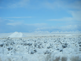
Montana, Idaho, Nevada, and Tahoe were trying.  After staying another day at the hotel in Billings to wait out the record-setting snowstorm, we trooped on.

PS - It was negative 7 degrees Fahrenheit in Billings -- so cold that when you stepped outside and took a breath, the snot inside your nose crystallized into ice boogers.
 

through Norbie's eyes

It was scary -- the worst part, worse than the nonexistent visibility and ice-rink roads, was getting passed by trucks going 75 mph.  Since plowing was minimal and at times absent, the fast lane was buried in inches of wintry goo.  When trucks flew by they pummeled Norbie and shrouded his face in a cloud of snow/ice-stuff, rendering the driver temporarily blind.  Good times.

I saw more accidents, slide offs, and jack-knifed tractor trailers and RVs than I could count.

When we reached clear roads in Nevada, we thought we were out of the woods.  But as these things go, the gloomiest woods were still ahead of us.

chain worker

At the Nevada/California line on I-80, every vehicle was checked to make sure it had either (1) snow chains or (2) a combination of 4-wheel drive and snow tires.  Norbie has 4WD, but he wasn't wearing his snow boots.  We snowed them pretty good because they let us go without much trouble.

The Donner party picked a rough spot to camp

We also snowed them a little while later at an "agricultural check-point."  Its purpose is to prevent the introduction of "non-native species" and pests that may harm plant life in the Tahoe region.  A woman asked us if we had any produce (we did), or if we had any plant materials (we did, and there was an installation of dried plants hanging above Sancho's head).  Naturally we said "no" and "no."  She let us by with a smile.

I-80 through Tahoe was concurrently the worst road conditions thus far and the best winter driving experience to date.  My (and Norbie's) confidence was up from several days driving through shitty weather (the entire length of Montana, Idaho, and a few spots in Nevada).  The speed limit through Tahoe was reduced to 30 mph, and by and large the Californians obliged.

It was great.

When we were about halfway through Tahoe, they completely shut down I-80 westbound to attend to the many accidents/slide offs.


We sat for at least an hour and a half.  I peed in front of many motorists.

shameless

Sometime during this series of events, Sanch and I decided that there must be some sort of prize for the strong who survive this.  When we came out of the mountains and reached Sacramento, the survivors were rewarded with a brilliant sunset.

 
Sacramento sunset prize

Friday, November 19, 2010

Badlands, South Dakota

Bad, Bad, Bad Lands

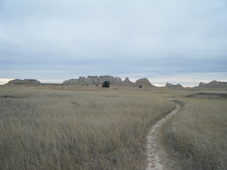
There's not much going on in South Dakota.  Until you reach the Black Hills on the extreme western edge of the state, it's flat.  Even the Badlands are only fleeting distractions from the immense flatness that surrounds you.  Unlike the flatness of Michigan, Wisconsin, and Minnesota, the flatness of South Dakota seems more raw (or, less arable, depending on who you talk to) - which would explain the shift from farmed fields to fields of grazing cattle.

Our goal was to make it to Badlands National Park from St. Paul in one day (600 miles).  We succeeded.  Our only stop was at a Cabela's superstore -- the world's foremost roadside attraction.  In the world's foremost outdoor parking lot, we met a man from Ohio whose wife is from Pennsylvania.  He took interest in our license plate and our quest.  He wished us well.  We grabbed the necessities - a new Petzl headlamp, a can of isobutane/propane fuel for our stove, and a TacoBell grilled stuft burrito (Audrey).  Oh, America.  How you sustain me.

Badlands sunset

We arrived at the Bad-asslands just before sunset (which is before 5 pm - fuck).  We camped at the main campground, so as to be close to the limited selection of hiking trails in the morn.  After a somewhat fitful rest in ol' NorthFace, we were ready to hike at 8:40 am.

Juniper

We nibbled some wild juniper berries, which tasted unsurprisingly gin-like.  They were delicious but had a heinous aftertaste.  You win some, you lose some in the game of wild edibles.


A day in the life

Sancho scaled most scalable things

What the hell are these?  Only dinosaurs can tell.

The "Notch Trail" featured this bangin' cable & post ladder.  It was a breeze to ascend, but a little Indiana Jonesy on the descent.


After the Notch Trail, we hiked Castle Trail to Medicine Root Trail.  10 miles in under 5 hours - easy,  breezy, beautiful.


Sanch- -- draw this plant, plz!


Besides the rock formations, the highlight of Badlands N.P. was seeing so much wildlife.  We saw:

1) mule deer, lots of em
2) several bighorn sheep, including a ram
3) hare
4) LOTS AND LOTS OF BISON (aka buffalo)
 
 Loner at sunset

Our campground the second night (Sage Creek) was located off of the Badlands Loop Road - 12 miles down the dirt "Sage Creek Rim" road.  We shared the space with a herd of 800 bison that roam within the park.
 
 Sage Creek Campground sunset

They be grazin'

I'm not going to lie, I was a wee bit scared.  Just like my slight fear of moose -- I don't want to mess with 2,000 pound animals. Luckily, the bison we met seemed even more mild-mannered than moose. They were majestic and calm.  We humans have a lot to learn.

Morning light

After a stressful yet adventurous night (extreme winds forced us to a cramped slumber inside Norbie), we were on the road at the break of day.

We saw some more mule deer on the way out.  And lots of bison.


Wyoming was amazingly sparse.  With a population of just over 600,000, it is the least populated state in the USA.  We're talking 25 miles between highway exits.  Yeah.

As soon as we entered Montana, we encountered steady snowfall.  The first real snow of the season.  Up here in the wild, wild west, they believe that snow removal is for sissies.  No chemicals, not even sand.  Do they plow?  I'm not sure.  In any case, extreme winter conditions forced us off the road and into a Hampton Inn whose highway billboard advertised a 24-hour swimming pool and hot tub.  So I won't get to fulfill my road trip wish of not staying in any hotel/motel.  But what's a road trip without unexpected hardship?  Not much of an adventure, I say.